
Newkirk Plaza & Cortelyou Road
Learn more about the history of these two historic places!About Newkirk Plaza
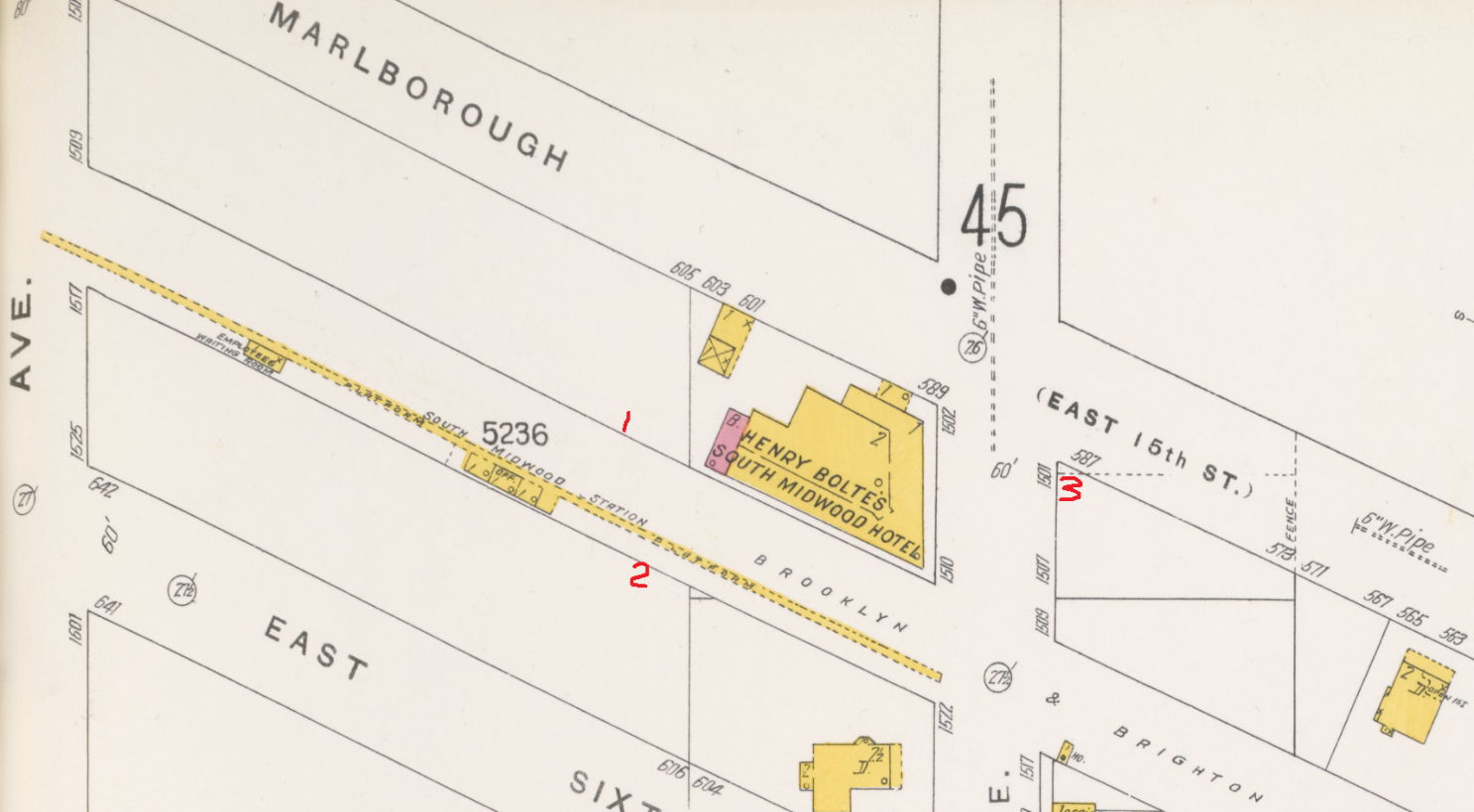
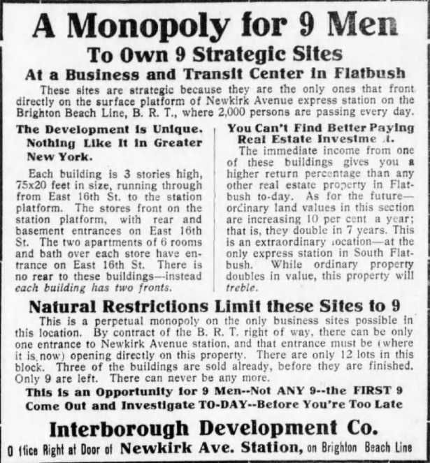
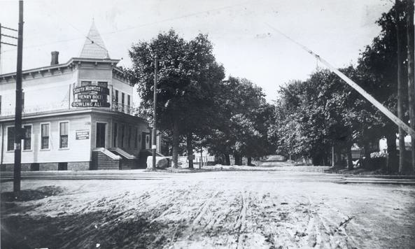
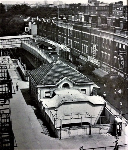
Newkirk Plaza was created in 1910 and owes its existence to the lack of structures along the path of the Brighton railroad between Foster and Newkirk Avenues at the turn of the 20th Century, aside from the Henry Bolte Hotel which faced the tracks at the southeast corner of Marlborough Road and Newkirk Avenue. The red numbers on the 1905 insurance map below indicate the present location of the three stores we’ve discussed. Note the wooden platform and not much else except the hotel.
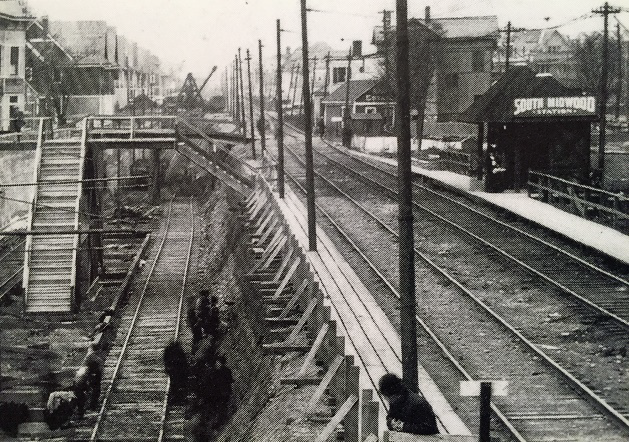
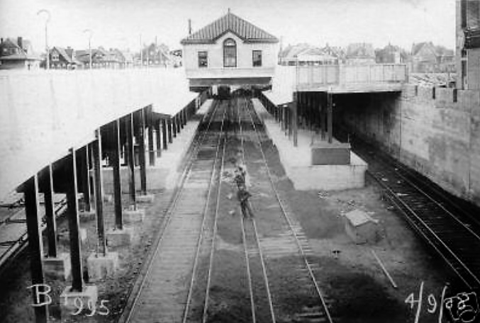
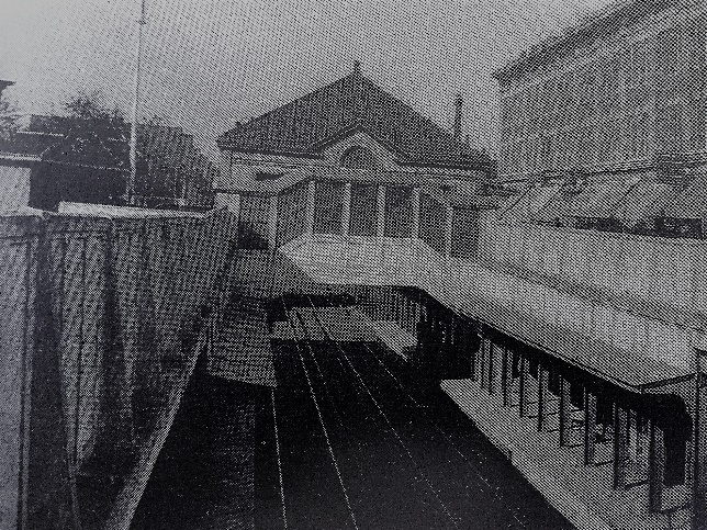
Before the Brighton line was submerged as part of the Grade Crossing Elimination Project, memorialized in a plaque on the east wall of the Plaza station house, the railroad planned to add two tracks for express service and an express station in Flatbush south of Church Avenue. To do this it needed to add about 20 feet on each side of its existing 50-foot right of way. Cortelyou Road and Newkirk Avenue were the only alternatives considered. Cortelyou Road had a trolley that intersected with the railroad and an expanding commercial strip. Its merchants lobbied hard for the express, realizing the additional foot traffic it would produce. But too many buildings lined the tracks around Cortelyou, making expansion of the roadbed impracticable. And so an agreement was reached with the landowners surrounding the Brighton line’s two surface tracks at the Newkirk stop. The railroad secured an easement of 19.5 feet on each side to make room for two island platforms between the local and express tracks. In return, the railroad restored to the property owners the entire width of the easement by constructing concrete pavement at ground level to form a roof over the local tracks.
The landowners then hired a local notable builder named C. F. Bond, the brother-in-law of the prolific developer of Fiske Terrace, Beverly Square and other Flatbush enclaves, T.B. Ackerson. A former railroad man himself, Bond convinced the owners that since there was not enough space to build a new road atop the railroad, they should instead build stores along the entire eastern length of the platform with apartments above. The stores would be 40 feet wide (or subdivided to half that width) and extend 60 feet to East 16th Street where the only stairways to the apartments would be built, alongside the doors for delivering supplies to the stores. With 4,000 riders passing every day the shops were an instant success. By 1922 a new station entrance was created on the west side and the same process was repeated there, albeit with less uniformity.
About Cortelyou Road
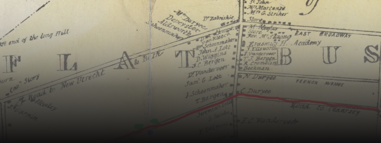
On 19th Century maps, Cortelyou Road west of Flatbush Avenue was labeled “Road to New Utrecht,” and eastward it was dubbed “Road to Canarsie.” It was also the only direct path from the west to the 96-acre Holy Cross Cemetery which opened in 1849. In 1873 a street grid was created for Kings County. On this virtual map, Canarsie Road became Avenue C and in 1902 it was officially changed to Cortelyou Road, named for Jacques Cortelyou who in 1657 founded the settlement that became New Utrecht.
In 1904 as the Brighton railroad moguls planned the future of the line, they proposed making the Cortelyou Road station, established in 1898, an express stop if the Flatbush citizenry would agree to abandon the Beverly Road station, established in 1898 a long block away. The old fiendish divide-and-conquer ploy. But once Beverley Road was toast, would the railroad simply announce that Newkirk Avenue had to be an express stop (see above), so tough luck, Cortelyou. But the emerging settlers in Beverley Square and Ditmas Park sided with their northern neighbors and Beverley Road was saved. The shopkeepers on Cortelyou Road were disappointed, however. After all, unlike Newkirk Avenue, they had an important electric trolley line running east to west, uniting East Flatbush and Vanderveer Park with Kensington, making Cortelyou Road an important transfer point. But the Cortelyou station lacked the space for a buildout of two express platforms, so tough luck, Cortelyou merchants.
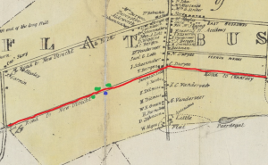
1842: Red Line will be dubbed Cortelyou Road in 1902. Blue dot will become a station; Green=stores discussed below.
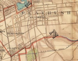
1890